**Many of the projects I’ve worked on are proprietary. I will provide dummy code and data as demonstrations of my work.
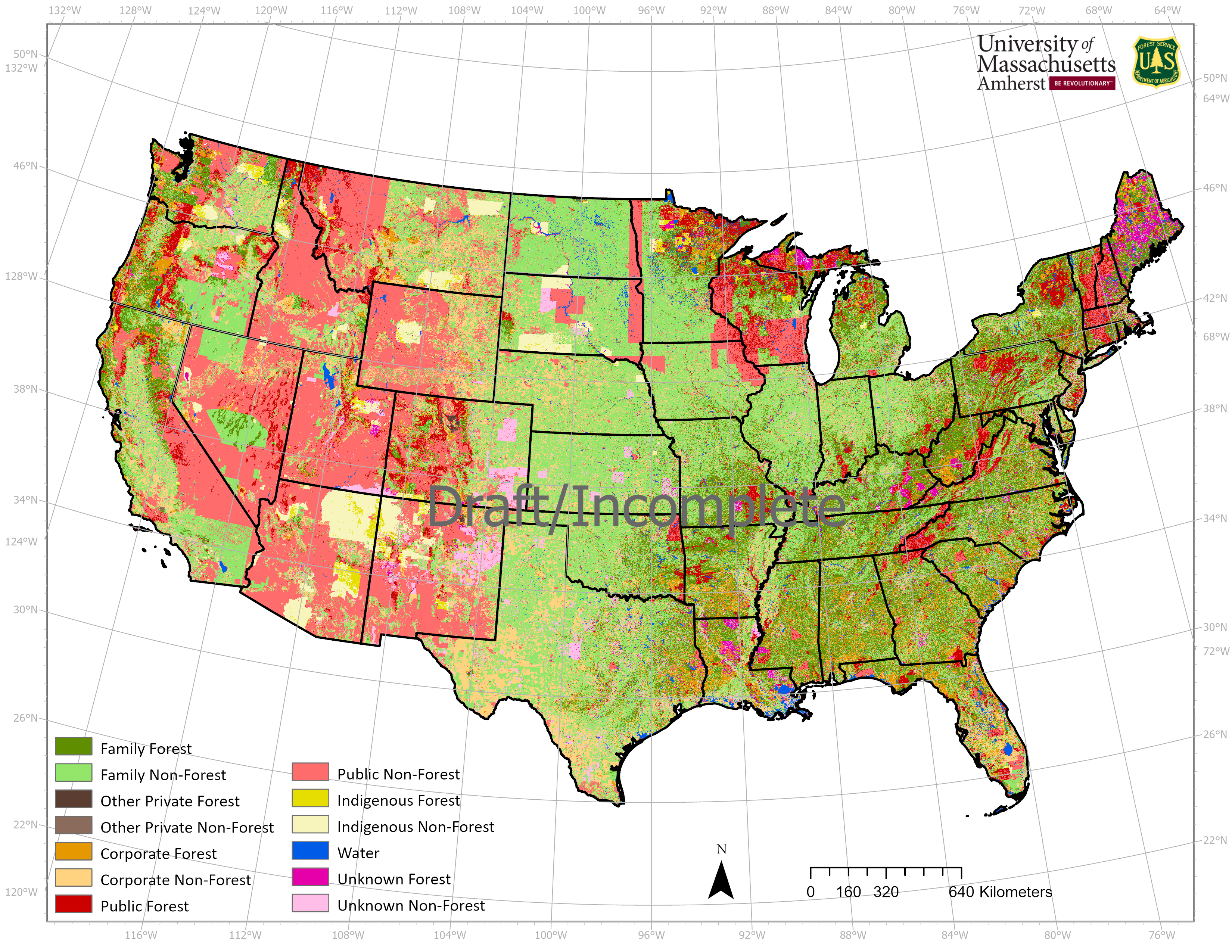
FIA Ownership Map This project, hosted on GitHub, contains the code and processes used to generate the FIA Ownership Map. It includes scripts for data preprocessing, machine learning classification, and map generation, leveraging a range of spatial data sources. For more details, visit the FIA_OWN_MAP GitHub Repository.

Road Network Correction This project aims to improve the accuracy of road network data by identifying and correcting error-prone OSM data using satellite imagery, Machine Learning, and Apache Spark.
Example Code Coming Soon
ACT | West Analytical & Mapping Automations This support was set up for the FHI360 ACT | West Division whose primary goal was to eliminate Neglected Tropical Diseases from a portfolio of countries in west Africa. I automated there geoanalytical and mapping needs to support monitoring and evaluation, survey design, and new research.

Example Code Coming Soon
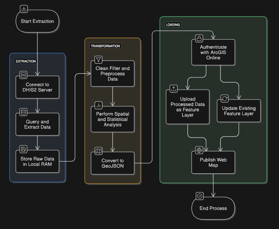
ETL Pipelines for Geostatical Small Area Estimation Modelling FHI 360’s work primarily focused on highly rural and economically disadvantaged regions, which often resulted in limited data coverage. My role involved compiling continuous datasets across the study area to correlate with available indicators. These indicators were then used to estimate values for areas with low or no data coverage. Within this framework, I leveraged various environmental and social data sources through APIs and processed the data using Python. The processed data was then stored in PostgreSQL databases, supporting multiple projects.
Demo Coming Soon
Accessibility Analysis Analyzed the availability, affordability, and proximity of medical services to different populations. It involves assessing geographic access, financial barriers, and social determinants. By integrating spatial data, demographic insights, and statistical modeling, this analysis helps identify underserved areas, optimize resource allocation, and inform policies aimed at improving equitable healthcare access.
Demo Coming Soon
Diagnostic Network Optimization Focused on enhancing the efficiency, accessibility, and coordination of diagnostic services within a country’s healthcare system. This project involved modelling the various laboratory locations, optimizing patient/sample referral pathways, and ensuring equitable access to essential diagnostic tests. By leveraging data analytics, spatial modeling, and operational research, optimization efforts aim to reduce turnaround times, minimize costs, and improve patient outcomes.
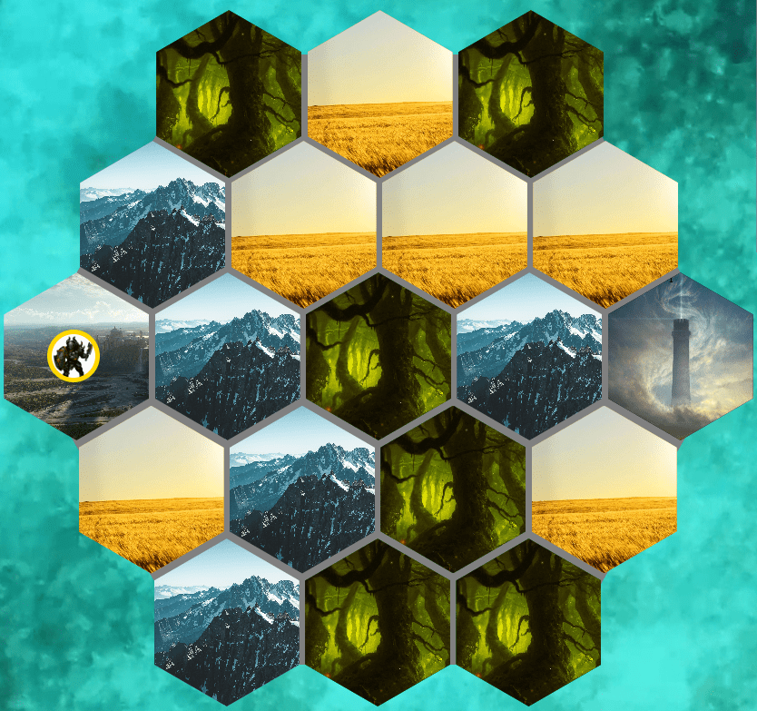
DndHexCrawler is a fun personal project I built in pure JavaScript to simulate a hexagonal grid-based world, inspired by Dungeons & Dragons. The program allows users to explore a procedurally generated map, where each hex tile represents different terrains, such as forests, mountains, or plains. Click the image for the github repo. You may play the game by going to play.

RankAFA Anime Art Ranking Application is an application where users can add, edit, and compare their favorite anime art. This web-based tool allows anime fans to showcase their top-rated artwork, edit rankings, and compare the art to see which one comes out on top. It’s designed to create an interactive and engaging platform for anime enthusiasts to organize, rate, and share artwork.
